

Planning a campground means laying out loops, pads, and utilities that fit the land, and much of that work can be done with free tools. This guide compares five options — SketchUp Free, QGIS, Google Earth Pro, FreeCAD, and LibreCAD — covering what each does well, who it suits, and where it falls short.
How we put this list together: we went through each tool’s official website, pricing page, and documentation, and checked what the free plan actually includes and where the paid tiers begin. Prices and plan limits change often, so confirm the details on the vendor’s site before you commit.
My take
Going through these tools, I came away convinced that the biggest mistake in campground planning is starting with a pretty 3D model. A layout that looks great in SketchUp can fall apart once you account for slopes, drainage, setbacks, and where water and power can actually run.
That is why I would sequence the work rather than pick one tool. Start with Google Earth Pro and QGIS to understand the land, then sketch loops and pads in SketchUp once you know where they can go. QGIS has the steepest learning curve on this list, but it is also the only free tool here that tells you whether a site is buildable.
FreeCAD and LibreCAD are worth knowing about mainly for the handoff stage. Your engineer or county reviewer will likely want proper drawings, and having clean DXF files ready can save a round of revisions. For early planning, though, they are more precision than most park owners need.
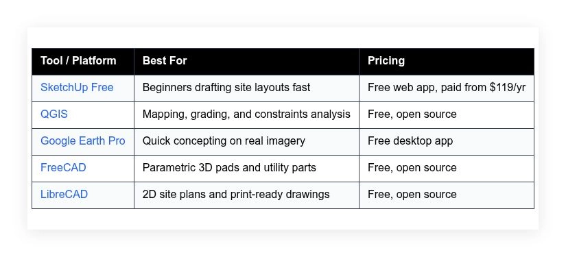
Comparison of 5 best campground design software in 2026 with pricing and recommended use cases
Below is a closer look at each tool, followed by our overall recommendations.
What is a campground design software?
Campground design software is a set of tools that help plan, draw, and evaluate campsites, loops, roads, and utilities, with the goal of a clear, accurate, buildable site plan. The measure-twice, cut-once principle applies: good planning tools help you measure once in the field, then test ideas on screen before any ground work.
A clear digital site plan with real distances can save weeks of rework — shifting ten RV pads by two feet can avoid tree removal and cut thousands in costs. At its core, campground design software lets owners, planners, and volunteers map terrain, place pads and amenities, check grades and setbacks, and share drawings that contractors can follow.
Many teams pair mapping tools with spreadsheets for cost tracking, Google Drive for sharing, and photo tools to document site conditions before and after work. Not every tool is equal, so it pays to choose with care.
How to choose the best campground design software
It can feel overwhelming — free apps, trials, and pro suites, each claiming to be simple, and the wrong pick can slow your project for months. We wrote this to help you match your needs with the right tool, not the flashiest demo; your site, budget, and timeline should drive the choice.
A few questions worth asking:
- How generous is the free tier, and are exports locked?
- Can you do core tasks fast, like measuring, drawing pads, and labeling?
- Will it scale from 10 to 150 sites without a rebuild?
- What will it cost if you add imagery, terrain, or collaborators?
- Does it cover your must-haves, like contours, print layouts, or KML export?
- Can you track distances, slopes, and changes in a way you can trust?
- How hard is it to migrate drawings or data if you switch later?
- Is the app stable, with backup and version control options?
- Does it support GIS data, CAD layers, and basic coordinate systems?
The ranked list below answers these questions to help you move from sketch to site plan.
5 best campground design software in 2026
Here are our top picks for the best campground design software:
- SketchUp Free
- QGIS
- Google Earth Pro
- FreeCAD
- LibreCAD
1. SketchUp Free

SketchUp Free is a web-based 3D modeler designed for quick concept work and clean drawings. It comes from Trimble, a long-standing name in AEC and geospatial tools, so it is not a fly-by-night project.
You can start in seconds with a browser and a free Trimble ID, and the interface is direct: draw lines and faces, push-pull volumes, and use guides to nail distances. For campground planning, you can place pads, bathhouses, and simple road sections, then use tags for clear layers. Recent updates improved web performance and file handling, which helps on lower-power laptops at the ranger station, and Trimble’s 3D Warehouse still gives you a deep catalog of objects, like picnic tables and bollards, to speed mockups. On paid tiers, SketchUp adds desktop apps, advanced import and export formats, and the Add Location feature for terrain and imagery — options that make a real difference for grading studies and setout plans.
SketchUp Free is fast for early versions of loops and pull-through pads — you can test a new turn radius idea in minutes and share a link. Support materials are plentiful, with short tutorials and community answers, and drawings print cleanly, which keeps review meetings focused.
How SketchUp Free works and key features
The web editor is WYSIWYG and snappy: you sketch edges, create faces, then push-pull to add depth, with inference snaps that keep everything square and aligned without extra tools. You can start from templates with units set to feet or meters and customize tags for loops, utilities, and setbacks, the 3D Warehouse lets you drop ready-made assets, and advanced users can import and export common formats on paid tiers, while the free plan handles native files and basic exports.
Measurement tools make distances and areas clear, scenes and styles help you prep clean views for printing, and while there are no built-in analytics, the geometry stays precise so you can trust dimensions. Automation is light — you work interactively, but components can be reused to speed repetitive placements, and for extras like layout documents the desktop versions cover that on paid plans. Overall, it is beginner-friendly, with enough structure for accurate site plans if you keep layers organized.
Who SketchUp Free is for
Best for small park owners, volunteer trail crews, outdoor nonprofits, municipal planners testing concepts, and RV park operators prototyping pads. It excels at quick layouts, spacing checks, and simple massing. If you need georeferenced terrain or CAD-grade drawings, the paid tiers or a GIS tool will fit better. No advanced technical skill is required to start.
SketchUp Free pricing
SketchUp’s pricing is tiered by features and where it runs. The web-based SketchUp Free costs nothing for personal use and covers core modeling.
- Free: $0/month, web only, includes core 3D modeling and 3D Warehouse access
- Go: $119/year, web and iPad, includes additional import/export formats and mobile tools
- Pro: $349/year, desktop and web, includes LayOut for documentation and advanced file support
- Studio: Higher annual price, Windows only, adds advanced tools for large workflows
For campground planning, the free tier is a strong start. Pro becomes worth it if you need LayOut sheets or terrain from Add Location, which lives on paid plans. Annual billing applies on paid tiers and is the standard offer.
SketchUp Free pros and cons
- Pros: Fast learning curve, clean drawings, massive 3D Warehouse, free web access
- Pros: Solid for pad spacing, road testing, and concept reviews
- Pros: Good value on free, with a clear upgrade path
- Cons: Free tier lacks geolocation and advanced exports
- Cons: Not a GIS, so grading and contours require another tool
- Cons: Browser performance can dip on very large models
Choose it if you need speed and clarity for early site plans. Skip it as your only tool if you require contours and coordinate precision.
SketchUp Free reviews
Major review sites cover SketchUp broadly, including paid tiers. If you want third-party sentiment, you will find strong ratings on software review platforms and an active user forum with practical tips.
2. QGIS
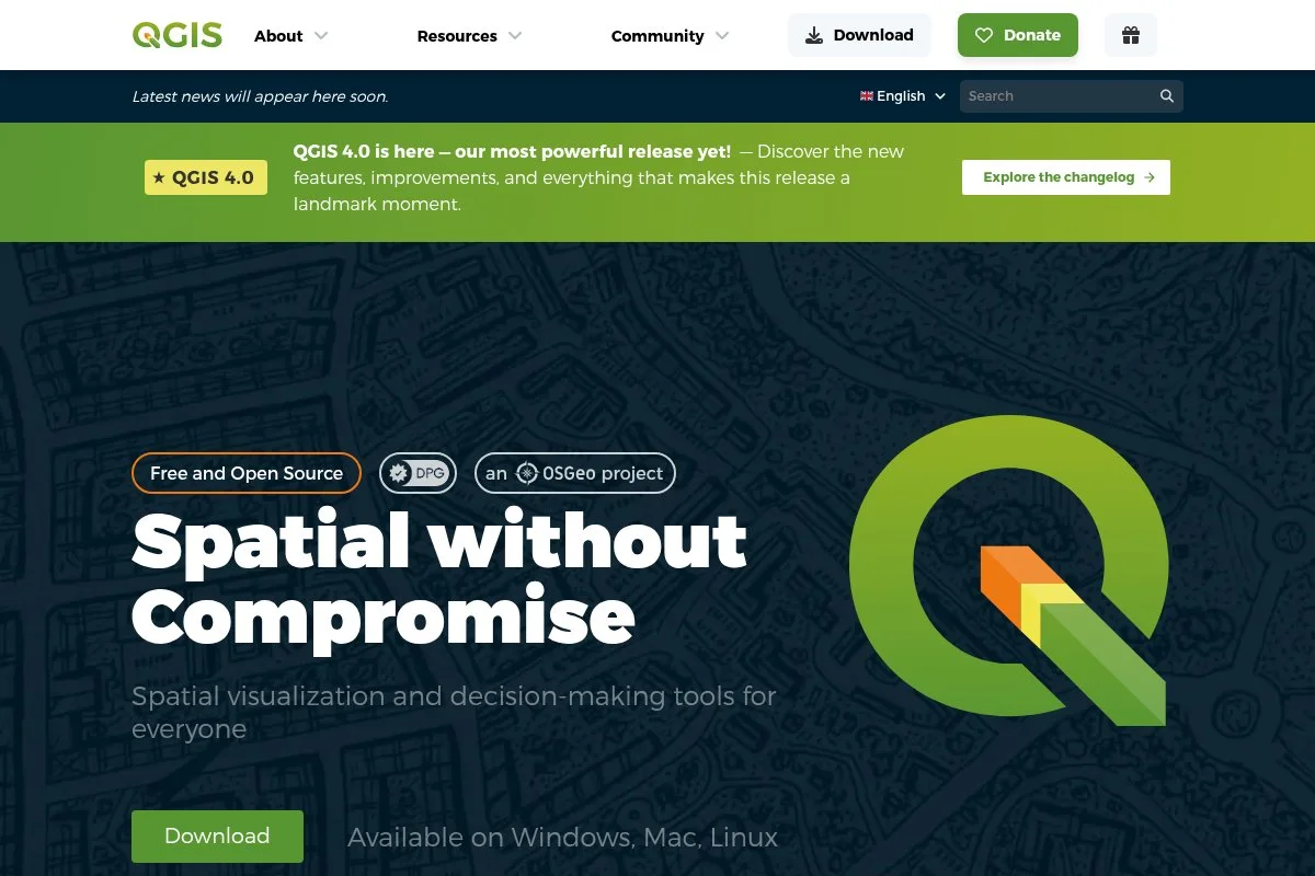
QGIS is a full-featured, open source GIS designed for spatial analysis and cartography. It is maintained by a global community and widely used by cities, NGOs, and consultants.
You start free on Windows, macOS, or Linux, and the interface uses layers and panels, with tools for measuring, digitizing pads and loops, and labeling. It brings in aerials, parcel lines, contours, and hazards so you can test setbacks and slopes before any drafting. Recent releases improved speed, styling, and plugin quality, and the plugin ecosystem is strong, which means you can add features like elevation analysis, route planning, and print composers without extra cost. Advanced features include geoprocessing, terrain modeling from DEMs, and print layouts that produce scale-accurate sheets — detail that is hard to match in lighter tools and makes QGIS a keeper for feasibility work.
QGIS is the right tool when a site has wetlands, flood zones, or tricky grades — it helps avoid expensive mistakes before final drawings. The community is helpful, with guides, workshops, and example projects, and once you build a simple template, repeat projects move quickly.
How QGIS works and key features
QGIS centers on a layered map canvas: you add rasters like aerials and DEMs, then vector layers for roads, pads, and utilities, with precise editing, snapping, and attribute tables for data-rich features. It ships with cartographic templates and you can customize symbology to match your park standards, while advanced users can write expressions, use the field calculator, and connect to PostGIS; integrations are wide, from GeoPackage to shapefiles and WMS basemaps.
Analytics include distance, slope, aspect, buffers, and overlay checks, Print Layouts produce scale bars, legends, and north arrows for permit sets, and you can automate tasks with models and Python scripts to repeat workflows. Extras include forms, georeferencer, and GPS integration, with community-based support, documentation, and forums. The experience is powerful for advanced users, and beginners can learn basics in a weekend, then add skills as projects grow.
Who QGIS is for
Great for municipal planners, environmental consultants, campground owners near sensitive areas, trail builders, and any team that needs contours and constraints mapped. It shines for grading checks, setbacks, and permit-ready maps. If you only need quick sketches, SketchUp or Google Earth may be faster. Some GIS learning helps, but you can start with tutorials.
QGIS pricing
QGIS is free and open source. There are no feature-locked tiers. You download the installer and get the full application.
- QGIS Desktop: $0/month, full feature set, includes core plugins and print layouts
- QGIS with external services: $0/month, plus optional costs if you add paid basemaps or cloud databases
Compared to paid GIS, this is outstanding value. Your only costs are training time and optional data. Many organizations also pay for commercial support from third parties, which is not required to use QGIS.
QGIS pros and cons
- Pros: True GIS analysis, contours and slope, permit-ready print layouts
- Pros: Free and open, huge plugin library, wide file support
- Pros: Accurate measurements and coordinate control
- Cons: Steeper learning curve than simple design tools
- Cons: Interface can feel dense for first-timers
- Cons: Requires separate CAD app for detailed construction drawings
Pick QGIS if your site needs analysis before design. If you only need a pretty mockup, it might feel heavy.
QGIS reviews
QGIS does not have a single official rating source. It is widely used by public agencies and nonprofits, with many positive case studies and active community support forums.
3. Google Earth Pro

Google Earth Pro is a free desktop app focused on viewing and marking up high-resolution imagery and terrain. It is backed by Google’s mapping stack and used widely for quick site context.
Getting started takes a simple download: you can draw paths, polygons, and placemarks on top of imagery, then measure lengths and areas, which is useful for sketching loops, marking hazards, and producing quick screenshots for stakeholders. Google has kept Earth Pro stable and free, and historical imagery is the quiet hero here, letting you see tree cover and water patterns over time, which can guide pad placement. Advanced users export KML and KMZ to share or to bring into GIS tools like QGIS, and elevation profiles help with trail and road checks, which is useful for RV grades and switchbacks.
It is not a drafting tool — it is fast context, not a construction drawing app — but it is useful for early planning and real-world checks. Support resources include help docs and a large community of users who share tips and overlays.
How Google Earth Pro works and key features
The interface is a 3D globe with search, layers, and places panels: you add folders for your project, then draw polygons for pads, paths for roads, and add labels, with imagery and terrain on by default. There are no templates, but you can style features and set icons, and advanced users export KML, overlay custom images, and import GPS tracks — it plays well with other tools that accept KML.
Analytics are simple — distances, areas, and elevation profiles — and there is no automation, but duplicating features and folders is quick, with extras like historical imagery and street view for context near access roads. Overall, it is very beginner-friendly and pairs well with a CAD or GIS app for formal plans.
Who Google Earth Pro is for
Perfect for owners, boards, donors, and volunteers who need fast, real-world visuals. Use it for rough layouts, access planning, and quick checks on slopes. If you need precise, scaled drawings, move to QGIS or a CAD tool. No technical skill required to start.
Google Earth Pro pricing
Google Earth Pro is free. There are no paid tiers for the desktop app. You download it and start working.
- Earth Pro Desktop: $0/month, full feature set, historical imagery, KML/KMZ export
- Earth Web and Mobile: $0/month, quick viewing and simple markup in browser
Compared to any paid imagery tool, this is hard to beat for early planning. If you need licensed orthos or survey-grade data, you will add other sources.
Google Earth Pro pros and cons
- Pros: Free, fast context on real imagery, historical views
- Pros: Easy measuring and elevation profiles for grade checks
- Pros: KML export plays nicely with GIS and CAD workflows
- Cons: Not a drafting or print layout tool
- Cons: Imagery dates vary, accuracy depends on location
Use it for vision and alignment. Do not rely on it alone for construction documents.
Google Earth Pro reviews
Google Earth products are widely referenced in planning circles. Formal star-rated reviews vary by site, but user feedback is consistently positive for quick planning and visualization.
4. FreeCAD
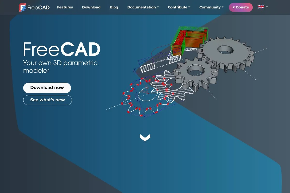
FreeCAD is an open source, parametric 3D modeler focused on precision. It is built by a global community and used for engineering, product design, and architectural experiments.
You install it free on desktop, and the interface uses workbenches like Part, Sketcher, and Draft — useful for modeling pad details, service pedestals, and simple structures that benefit from exact dimensions. Recent builds keep improving stability and BIM-adjacent features, and the Arch and Draft workbenches make it more practical for site elements than it used to be. Advanced features include constraints, assemblies, and exporting to standard formats, and parameter-driven designs are the draw here, letting you change a single value and update a whole family of parts.
It is not meant for full site plans; it works best as a companion for parts that need accuracy, exported to share with the broader team. The documentation and forum are active, and once you grasp constraints, the control you get is worth the time.
How FreeCAD works and key features
FreeCAD starts with sketches: you draw profiles with constraints, then pad or pocket them into 3D, and the parametric stack tracks every step so edits ripple through the model. Templates are minimal, but you can save your own, and advanced users script with Python, import DXF, and export STEP and STL — it is highly technical, so it rewards careful setup.
There is no analytics in the GIS sense, but measurements and tolerances are exact, automation comes from constraints and scripts, and extras include TechDraw for sheets and Arch for simple building elements. Overall, it is powerful for advanced users, with a steeper path for beginners.
Who FreeCAD is for
Ideal for fabricators, maintenance teams, DIY builders, and owners who need exact dimensions for pedestals, kiosks, or structures. It excels at parametric parts and detail components. If you want quick sketch layouts, use SketchUp or Earth. It requires technical patience and some CAD habit.
FreeCAD pricing
FreeCAD is free and open source. All features are available without a license or tiered paywall.
- FreeCAD Desktop: $0/month, full parametric modeling, includes Arch, Draft, and TechDraw workbenches
As a zero-cost parametric tool, the value is strong. Your investment is time and learning. If you need vendor support, you would look to commercial CAD instead.
FreeCAD pros and cons
- Pros: True parametric modeling, precise dimensions, export to standard formats
- Pros: Free and open, with scripting for power users
- Cons: Steep learning curve and heavier interface
- Cons: Not purpose-built for site-wide planning or GIS
Pick it for detailed parts and repeatable designs. Skip it for fast concept layouts.
FreeCAD reviews
FreeCAD has an active community and many tutorial channels. Formal star-rated profiles vary by site, and counts are limited compared to commercial CAD.
5. LibreCAD
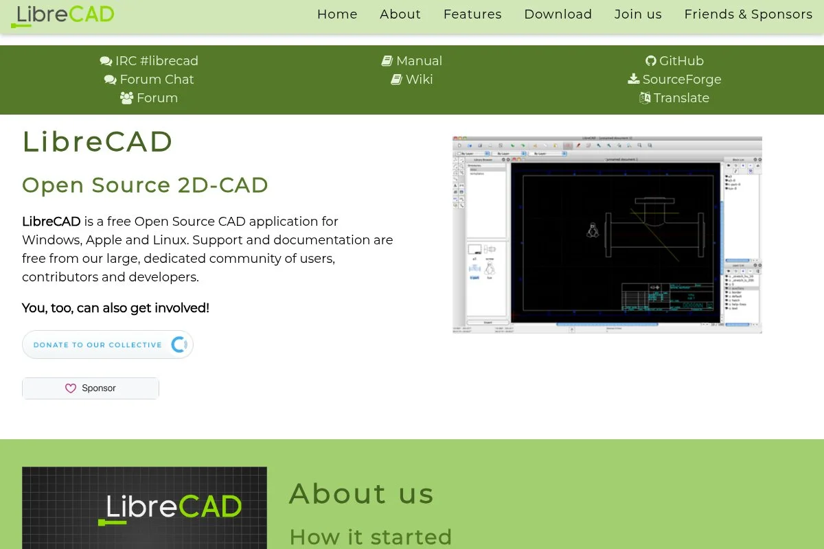
LibreCAD is a free, open source 2D CAD program focused on drafting. It is a practical option for line-accurate site plans and print-ready drawings without a license fee.
Install it on desktop and start with layers and blocks — for campgrounds, you can draft pads, stripes, setbacks, and dimensions in a clean 2D layout, and it prints well. Recent updates maintain compatibility and stability; it does not chase flashy features, which is good for teams who want muscle memory to stick. Advanced users benefit from DXF support, blocks, and layer controls, and you can export PDFs that contractors accept for basic layout work.
LibreCAD is the pick when a permit office wants a clear 2D plan with labeled distances. Community forums and wikis cover most questions, and once you set templates, your sheets come together fast.
How LibreCAD works and key features
LibreCAD uses a classic drafting interface: you draw lines, arcs, polylines, and add dimensions, with snaps, layers, and blocks keeping drawings consistent and tidy. There are no fancy templates, but you can build your own title blocks and styles, advanced users import DXF and export to PDF for sharing, and there is no 3D, no GIS, and no analytics.
Automation is minimal, but blocks speed repeated symbols like pedestals and picnic tables, and it includes print scale control for accurate output, with support relying on community docs. Overall, it is beginner-friendly for 2D if you have patience — focused and efficient for clean site sheets.
Who LibreCAD is for
Best for small parks, schools, and volunteer groups that need clear 2D site plans with measurements. It excels at printing scaled layouts for review. If you need contours or imagery, pair it with QGIS or Earth. No deep technical background is needed, but CAD basics help.
LibreCAD pricing
LibreCAD is free and open source. You get the full drafting feature set without tiers or trials.
- LibreCAD Desktop: $0/month, 2D drafting, layers, blocks, DXF support, PDF export
The value is strong if you need clean 2D without paying for a commercial license. If you require 3D or BIM, look elsewhere.
LibreCAD pros and cons
- Pros: Free, accurate 2D drafting, good PDF output
- Pros: Lightweight on older machines, simple toolset
- Cons: No 3D, no GIS, fewer import formats
- Cons: Interface feels dated compared to modern CAD
Choose it for print-ready plans on a tight budget. Skip it if you need terrain or complex geometry.
LibreCAD reviews
LibreCAD has limited presence on major review sites. Community feedback is favorable for basic drafting and print work.
What is the best campground design software right now?
The short version: SketchUp Free for fast concept layouts, QGIS for mapping and grading checks, and Google Earth Pro for quick visual planning on real imagery — each fills a different job, and together they cover most projects without cost.
SketchUp Free is our top pick. On value it is hard to beat for early design, and if you upgrade, Pro pricing stays predictable compared to heavy CAD suites that run far higher per year — for small parks, that difference pays for gravel or signage instead of software.
QGIS is the runner-up, and it shines the moment grades, wetlands, or buffers show up: if permitting or environmental review is part of your plan, start in QGIS, then switch to SketchUp for the final look, with recent improvements and plugin depth keeping it agile for field-to-office work. Its unique strength is spatial truth — you can measure slopes, check setbacks, and output scaled maps in one session — and if your focus is constraints or long trails, it may be the better daily tool.
Google Earth Pro is our third pick for teams that do not need scaled drawings yet: free, fast, and great for alignment meetings, since many projects start with Earth screenshots and arrows before moving to formal plans. The three combine well: Earth for context, QGIS for analysis, SketchUp for design — a mix that speeds buy-in and reduces expensive surprises. Choosing between SketchUp Free and QGIS can be tough; SketchUp Free comes first here because layout speed keeps momentum high, with grades checked in QGIS before committing.
Frequently Asked Questions
Q: What is the easiest free tool for a first campground layout?
SketchUp Free is the quickest way to draw pads, loops, and buildings with clean visuals. You can learn the basics in a few hours and share links easily.
Q: How do I check slopes and avoid steep grades?
Bring a DEM into QGIS and run a slope or elevation profile. Flag anything above your target grade, then adjust road alignments in your layout tool.
Q: Can I use Google Earth Pro drawings for permits?
No. Earth is great for vision and context. For permits, create scaled drawings in QGIS or a CAD tool and export print-ready PDFs with dimensions.
Q: What free exports do I need for contractor handoffs?
PDF for sheets, and either DXF or KML for reference geometry. Share a PDF plan, then provide KML for field checks in phone apps when useful.