

I learned land surveying software the hard way, juggling GNSS logs, control points, and CAD linework on tight project timelines. Field crews texted me screenshots. I needed results, not friction.
On a road rehab project, I wanted a clean field‑to‑finish flow. Data in, control checked, surfaces out, and plats drafted without burning the budget. That kicked off my hunt for free or low‑cost tools that still deliver professional results.
I talked with county surveyors, drone mappers, and small shops handling ALTA work. The theme was clear. The best teams standardize on a simple stack, then add one or two power tools for GNSS or photogrammetry when needed.
Finding the right combo is harder than it looks. Many tools look friendly on YouTube, then stall when you need projections, geoid models, or a least‑squares adjustment. Paid suites solve this, but the price can sting.
You do not need the most expensive suite to get reliable deliverables. With the right free tools, you can collect, adjust, map, and draft at a professional level, especially for small to mid‑size jobs.
This guide shares what actually worked for me. No sponsors. Just real picks, with tradeoffs called out plainly, and a clear path to get from raw data to deliverables.
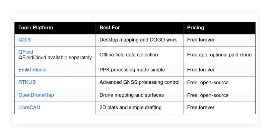
Here is a quick summary before we dive in.
Comparison of 6 best land surveying software in 2026 with pricing and recommended use cases
Scroll down for my detailed take on each option, including where they shine, where they fall short, and which one I picked for my own work. I also call out the best free starting points for beginners.
What is a land surveying software?
Land surveying software is a set of tools that help collect, process, adjust, and present spatial measurements. The goal is simple. Turn GNSS, total station, and drone data into reliable maps, drawings, and reports.
Surveying follows an old rule. Measure twice, cut once. Good software enforces that with coordinate systems, quality checks, and repeatable workflows. You get confidence in your positions, and clients trust the results.
Think of it like this. A clean PPK solution that tightens GNSS fixes to a few centimeters beats a quick phone GPS by orders of magnitude. That accuracy difference is the gap between a DIY map and a legal plat.
At its core, surveying software lets field crews capture points and lines, office staff process control and baselines, analysts build surfaces and contours, and drafters produce deliverables from accurate georeferenced data.
Many teams pair these tools with drone mission planners, control point targets, geoid models, and QA spreadsheets. GIS viewers, CAD editors, and cloud sync apps often round out the stack.
Not every option handles projections, adjustments, and linework equally well. Picking carefully matters.
How to choose the best land surveying software
There are so many tools that the choice can feel overwhelming. Field collection, GNSS processing, photogrammetry, CAD, and GIS all overlap, and each adds its own quirks.
I wrote this to help you find a stack that matches your work, not someone else’s marketing. Your jobs, hardware, and deliverables should drive the pick.
Most guides are written by vendors or media lists packed with paid placements. I am not sponsored by any platform on this list. What follows is my straight take from real projects and real headaches.
Here are some questions you should ask when looking for a tool:
- How generous is the free tier, and are core exports limited?
- Can I perform daily tasks fast, like stakeout prep or coding linework?
- Will it scale as I add crews, drones, or bigger sites?
- How does pricing grow with jobs, storage, and collaborators?
- Does it cover my must‑haves, like coordinate systems, COGO, and surfaces?
- What analytics or QA checks help me verify accuracy and metadata?
- How hard is it to migrate my projects to another tool if needed?
- Is it reliable, with clear logs, error messages, and recovery options?
- Does it support my hardware and data types, like RINEX, LAS, and GeoTIFF?
It is a lot to weigh, but my rankings below reflect these questions. I highlight where each tool fits best.
Okay, enough of me rambling, let us get into the list.
6 best land surveying software in 2026
Here are my top picks for the best land surveying software:
- QGIS
- QField
- Emlid Studio
- RTKLIB
- OpenDroneMap
- LibreCAD
Let us see which one is right for you.
1. QGIS
QGIS is a full desktop GIS built for mapping, data editing, and analysis. It has been developed by a global community for years and is used by governments, universities, and survey firms worldwide. That track record gives it real credibility for professional work.
It is free to download and runs on Windows, macOS, and Linux. Getting started is easy. The interface feels like a classic GIS, with layers, styling, and attribute tables. Daily tasks include coordinate transforms, COGO tools, snapping, topology checks, and print layouts.
Recent releases strengthened the plugin ecosystem and performance. Processing tools are faster, CRS handling is clearer, and project templates travel well between teams. That opens the door to smoother field‑to‑office handoffs and consistent symbology across projects.
On the advanced side, QGIS supports powerful expressions, model builder automation, and Python scripting with PyQGIS. Plugin highlights include CAD‑like editing, parcel tools, geocoding, and direct connections to PostGIS. Many paid suites cannot match this level of extensibility.
I use QGIS as my office hub. It anchors my CRS checks, base map styling, and final map layouts. I pair it with GNSS processors and drone tools, then bring results back into QGIS for QA and export.
One extra thing I appreciate is the documentation and community. Tutorials, sample data, and active forums make it much easier to solve problems fast.
How QGIS works and key features
QGIS uses a familiar layer panel with a map canvas and data browser. You can create and edit vector layers with snapping, constraints, curved geometry, and attribute forms that enforce required fields. Styling uses rule‑based and categorized renderers with scale‑dependent visibility.
Templates handle standard layouts, north arrows, legends, and dynamic text. Advanced users can write expressions or Python scripts to automate imports, projections, and batch exports. Integrations include GDAL, PostGIS, SpatiaLite, WMS, XYZ tiles, and popular file formats.
You can track feature counts, geometry errors, and layer statistics. The processing toolbox logs steps for repeat runs. Automation with models or scripts turns repetitive chores into one‑click tasks. Beyond mapping, you get forms, print composer, and geometry generators for clean cartography.
Support comes from docs, training providers, and a very active user base. As one municipal GIS lead told me, “QGIS replaced two paid tools for us and gave us more control.”
Overall, it is beginner‑friendly once you learn the basics, and it scales incredibly well for power users.
Who QGIS is for
Best for survey techs, small firms, public agencies, drone mappers, and GIS analysts. It shines for projection management, linework editing, parcel maps, and final layout exports. COGO tools and plugins help with bearings and distances. If you need native least‑squares adjustment or heavy CAD solids, you may pair it with other tools. No deep coding is required, but power users can script everything.
QGIS pricing
QGIS is free and open‑source. There are no license fees, watermarks, or feature locks. You can install it on as many machines as you want, and the core plugins are free.
- Free: $0/month, unlimited projects and layers, includes editing, styling, print layouts, processing toolbox, and plugin access
- Optional support: Varies by provider, commercial support and training available from multiple companies
Compared to paid GIS or survey CAD, this is outstanding value. If you need guaranteed support or enterprise deployment, budget for a support vendor. Many teams save thousands per seat per year using QGIS without losing capability.
QGIS pros and cons
- Pros: Free on all major OS, powerful CRS and editing, huge plugin library, excellent automation with models and Python
- Pros: Strong print layouts and symbology, great value for small teams
- Cons: No built‑in least‑squares network adjustment, CAD solids and advanced drafting are limited compared to survey CAD suites
- Cons: Interface can feel dense at first
If you want a dependable office hub without paying for a suite, pick QGIS. If you need full survey CAD with field‑to‑finish codes and drafting automation, you may still want a paid CAD tool in the mix.
QGIS reviews
Third‑party review listings for QGIS vary by site. Many users share feedback through community forums, GitHub, and training providers rather than on G2 or Capterra. Overall sentiment is strong among public sector and consulting users.
2. QField
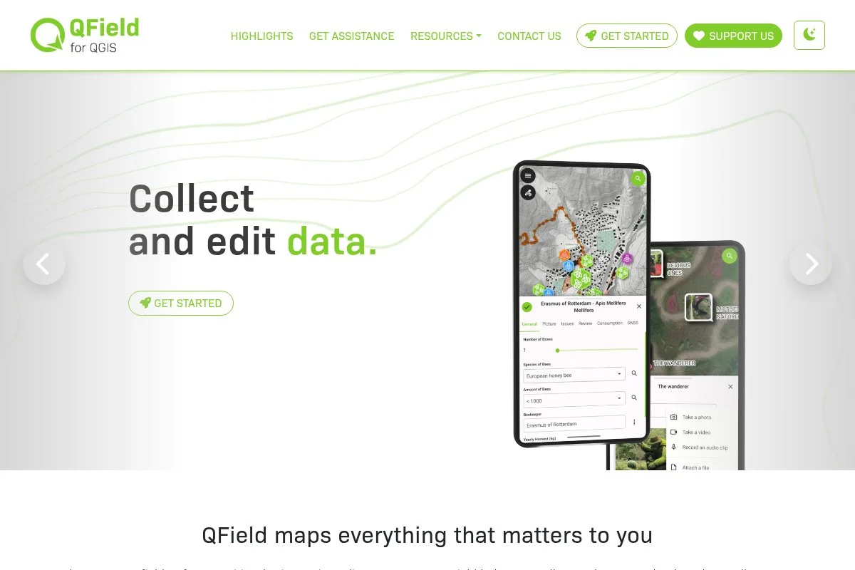
QField is a mobile app built for field data collection that syncs directly with QGIS projects. It is developed by OPENGIS.ch, a team deeply involved with QGIS development and training, which gives it strong technical credibility.
The app is free to install on Android and iOS. Getting started is as simple as exporting a QGIS project and loading it onto your device. You work with the same symbology, forms, and constraints you configured in the office. Daily use is all about point capture, linework, photos, and attribute forms with offline maps.
Recent updates improved offline reliability and made syncing smoother through QFieldCloud. That matters when crews are deep on site with no signal. It reduces version clashes and keeps projects consistent across multiple devices.
Advanced options include external GNSS receiver support, custom form widgets, and background maps. With QFieldCloud, you can manage multi‑user edits and conflict resolution. That workflow is rare for a free field app tied closely to a desktop GIS.
I keep QField on my phone and tablet. It is my go‑to for quick verification runs and attribute‑rich collection. It has saved me from bad notes more than once.
I also like the project‑driven design. If it looks right in QGIS, it looks right in the field, which cuts training time for crews.
How QField works and key features
QField uses a map‑first interface with large buttons for capture, snapping, and layer toggles. Forms mirror QGIS settings, so required fields and value lists carry over. You can use tile packages or MBTiles for fast offline basemaps.
Templates are QGIS projects with saved styles and form logic. Power users connect high‑accuracy GNSS receivers via Bluetooth and apply NTRIP corrections through the OS. You can track positions, attribute completeness, and photo attachments with EXIF tags.
Automation comes from the QGIS side. Expressions and defaults fill attributes on capture. Additional tools include measure, stakeout‑style navigation to targets, and multi‑geometry support. Support quality is solid through docs, community channels, and paid cloud support.
The overall experience is beginner‑friendly but scales well with QGIS expertise.
Who QField is for
Great for survey crews, utility mappers, environmental teams, foresters, and inspectors. It excels at offline collection with validated forms, quick stakeouts, and photo‑rich records. External GNSS support suits centimeter‑level work. If you need advanced coding or robotic total station control, look at dedicated survey data collectors. It is easy to learn if you already use QGIS.
QField pricing
QField is free to download and use on devices. There is no per‑device license for the app itself. Sync and collaboration features are available through QFieldCloud, which is a separate paid service.
- Free app: $0/month, core capture, forms, offline maps, GNSS connection
- QFieldCloud: Paid, optional for sync, team workflows, and conflict handling
Value is excellent. You get a serious field tool for free and only pay if you need cloud sync and team coordination. Many small teams start with local file transfer and add cloud later.
QField pros and cons
- Pros: Free app, tight QGIS integration, strong offline support, external GNSS friendly
- Pros: Consistent forms and styles between office and field
- Cons: Advanced survey instrument control is limited, relies on QGIS for heavy configuration
- Cons: Best multi‑user workflows require paid cloud
If your world revolves around QGIS, QField fits like a glove. If you need full survey controller features, you will need a different data collector or a paid suite.
QField reviews
Formal reviews on software directories are limited. Feedback is strong across the QGIS community and mobile app stores, with many teams adopting it for offline fieldwork.
3. Emlid Studio
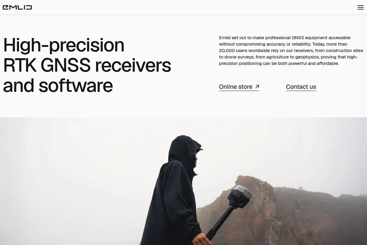
Emlid Studio is a free desktop app focused on GNSS processing, especially PPK. Emlid is known for Reach receivers and has grown a large user base among surveyors, drone pilots, and mappers. The app inherits that practical field focus.
It is free on Windows and macOS. Setup is quick. You load RINEX or raw logs, base corrections, and camera events if you are flying a drone. The interface guides you through processing, quality checks, and exporting corrected tracks and points.
Recent updates added more streamlined drone workflows and support for common receiver formats. That makes cross‑brand projects easier and reduces time spent converting logs.
Advanced features include Stop & Go processing for survey points, camera event timing for PPK photogrammetry, and simple coordinate system handling on export. The ease of use stands out compared to more technical GNSS tools.
I use Emlid Studio when I want fast, repeatable PPK without tweaking dozens of settings. It nails the 80 percent case and lets me move on to mapping.
I also appreciate the clean reports. They make it easy to document base location, processing settings, and final accuracy for clients.
How Emlid Studio works and key features
The interface is wizard‑like. You pick the workflow, add rover and base files, set antenna heights, and run processing. Results show fix rates, residuals, and plots, with exports in common formats like CSV and GeoJSON.
Templates are project workflows you repeat often, such as drone PPK with standard export fields. Advanced users can still inspect logs and adjust key parameters. Analytics highlight solution status and quality metrics for quick checks.
Automation is simple but effective. Batch multiple flights or sessions with consistent settings. The app focuses on its core mission rather than trying to be a full GIS. Support comes from docs, forums, and Emlid’s active community.
In short, it is beginner‑friendly, with enough control for serious survey work.
Who Emlid Studio is for
Best for drone pilots doing PPK, survey crews collecting Stop & Go points, construction teams verifying control, and small firms new to GNSS processing. It handles common PPK and point workflows cleanly. If you need deep experiment‑level tuning, head to RTKLIB. Technical skill is minimal to start.
Emlid Studio pricing
Emlid Studio is free to download and use. There are no usage‑based fees for processing GNSS logs or exporting corrected data. It complements Emlid hardware but also works with standard RINEX.
- Free: $0/month, PPK for drones, Stop & Go, quality reports, common exports
- Support: Included documentation and community forum, hardware support via Emlid if you own devices
Value is excellent, especially for teams building a PPK pipeline without extra software costs. Many alternatives wrap PPK into paid cloud services. Here, the desktop app is free with no limits.
Emlid Studio pros and cons
- Pros: Free, easy PPK, clean reports, supports common RINEX and event logs
- Pros: Great for drone workflows and Stop & Go
- Cons: Less control than RTKLIB for advanced tuning
- Cons: Not a full GIS or CAD, export and go mindset
If you want quick, reliable GNSS processing without a learning wall, it is a top pick. If you live for granular settings, you might prefer RTKLIB.
Emlid Studio reviews
Formal listings on G2 or Capterra are limited. Community feedback is active across the Emlid forum and user groups, with strong adoption among PPK drone users.
4. RTKLIB
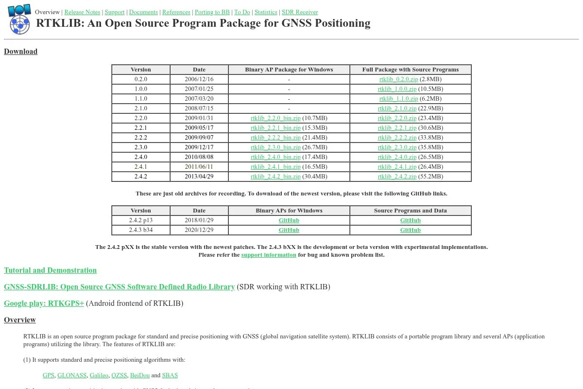
RTKLIB is an open‑source suite for GNSS processing created by Tomoji Takasu. It is a favorite among researchers and power users because it exposes deep configuration for RTK and PPK workflows.
The software is free. Getting started can take patience, since the interface prioritizes function over polish. Once you load RINEX files, base data, and antenna info, you can tune everything from satellite systems to ionospheric models.
Recent community builds improved stability and added conveniences in GUIs like RTKPOST and RTKNAVI. That narrows the gap between raw control and day‑to‑day usability.
Advanced capabilities include custom frequency combinations, precise ephemeris options, ambiguity resolution strategies, and fine‑grained constraints. Few free tools give you this level of control over GNSS estimation.
I keep RTKLIB for tricky jobs. When logs are messy or I need to squeeze accuracy from a rough baseline, the extra knobs matter.
I also appreciate that it is format‑friendly. If it is a standard GNSS file, there is a good chance RTKLIB can process it.
How RTKLIB works and key features
RTKLIB includes tools for real‑time navigation, post‑processing, and conversion. Interfaces vary, but RTKPOST is the go‑to for PPK. You configure observation and navigation files, set processing options, and examine residuals and solution status outputs.
Templates are saved option files you apply to similar jobs. Advanced users add custom models, precise products, and antenna calibrations. Output includes detailed logs, quality flags, and time series you can chart for QA.
There is no built‑in analytics dashboard, but the text logs are thorough. Automation is scriptable, so batch processing is realistic once you standardize settings. Community wikis and forums provide guidance when you hit a snag.
The experience favors advanced users. It is powerful once you learn it.
Who RTKLIB is for
Ideal for GNSS specialists, academic users, drone mapping leads, and surveyors who want maximum control. It excels at tough datasets and experimental tuning. If you want a guided workflow or pretty reports, use Emlid Studio. Expect a learning curve and some trial and error.
RTKLIB pricing
RTKLIB is free and open‑source, with source code available for customization. There are no usage fees or limits. Different community builds may package installers for convenience.
- Free: $0/month, full RTK and PPK toolset, conversion utilities, detailed outputs
- Community support: Wikis, forums, and documentation
The value is outstanding if you need its depth. The tradeoff is time invested learning the options. Some teams standardize a config and train staff to run it safely.
RTKLIB pros and cons
- Pros: Extreme control over GNSS processing, free and open, wide format support
- Pros: Scriptable for batch jobs
- Cons: Steeper learning curve, dated UI, limited guided workflows
- Cons: Documentation can feel scattered across community sources
Pick RTKLIB if you want full control and do not mind tinkering. If speed and simplicity matter more, go with Emlid Studio.
RTKLIB reviews
You will not find many polished listings on review sites. Most feedback lives in research forums, Git repositories, and user groups, where power users are vocal and helpful.
5. OpenDroneMap
OpenDroneMap is an open‑source toolkit for processing drone imagery into orthophotos, point clouds, and 3D models. It is maintained by a very active community and widely used by mappers, surveyors, and researchers.
The core software is free. You can run it locally or on a server. WebODM and NodeODM make it easier to manage projects and jobs. The basic flow is straightforward. Load images, set parameters, and generate outputs for GIS or CAD.
Recent development has focused on speed, memory efficiency, and large‑dataset handling. That matters when you process corridors or big sites with thousands of images.
Advanced features include ground control point support, PPK camera positions, split‑merge for huge areas, and DSM/DTM outputs. It also supports textured meshes and tiled web maps, which helps with client sharing.
I rely on OpenDroneMap for orthos and point clouds when I want full control over data and costs. It pairs well with Emlid Studio for PPK and QGIS for final mapping.
I like that it runs offline. Sensitive sites stay off third‑party clouds, which is important for some clients.
How OpenDroneMap works and key features
OpenDroneMap uses photogrammetry pipelines to reconstruct surfaces from overlapping images. Interfaces like WebODM offer project dashboards, task queues, and parameter presets. You can import GCPs and camera geotags or PPK trajectories.
Templates are presets tuned for different scenes, like urban or agricultural. Power users tweak feature matching, depth maps, and mesh refinement. Outputs include GeoTIFF orthos, LAS/LAZ point clouds, contours, DSM/DTM, and textured OBJ models.
Automation is strong with batch processing and API access. Analytics cover processing logs, quality indicators, and coverage maps. Community documentation and forums help with troubleshooting, and commercial support is available from ecosystem vendors.
Overall, it is powerful and flexible. Beginners can start with defaults, while experts tune for top quality.
Who OpenDroneMap is for
Built for drone mappers, survey firms, environmental consultants, and construction teams. It shines when you need orthos, point clouds, and contours without per‑map fees. Strong GCP support serves survey‑grade outputs. If you want a fully managed cloud with phone support, consider paid platforms. Some technical comfort helps.
OpenDroneMap pricing
The core project is free and open‑source. You can compile and run it without cost. WebODM offers paid installers and support, while the underlying engine remains free.
- OpenDroneMap core: $0/month, full photogrammetry pipeline, GCP support, standard outputs
- WebODM installer: Paid option for easy setup, includes updates and support from the vendor
Value is high if you process regularly. You avoid per‑project fees and keep data local. Budget for hardware if you run large jobs, since CPU and RAM matter.
OpenDroneMap pros and cons
- Pros: Free core, strong GCP and PPK support, large‑area workflows, rich outputs
- Pros: Offline processing protects sensitive data
- Cons: Setup can be technical, long runs need serious hardware
- Cons: Support depends on community unless you buy a support package
If you want full control and predictable costs, ODM is a great pick. If you need quick results and guaranteed help, a paid cloud may fit better.
OpenDroneMap reviews
Traditional review sites show limited entries. Feedback is active in community forums and GitHub. Many practitioners post solid results and repeatable workflows for survey‑grade outputs.
6. LibreCAD
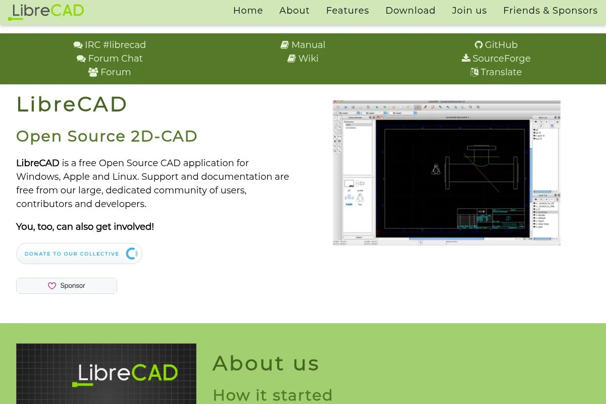
LibreCAD is a free 2D CAD application. It is not a survey CAD suite, but it is handy for drafting plats, simple details, and quick markups without paying for a full license.
It installs quickly on Windows, macOS, and Linux. The interface is a classic CAD layout with layers, snaps, and dimension tools. Daily tasks include linework cleanup, annotations, and DXF edits exported from your GIS.
Development has kept the project current and stable. While it is modest compared to big CAD, it fills a useful niche in a free stack.
Advanced features are limited, but you get blocks, polylines, hatching, and printing to scale. For a no‑cost editor to finalize simple deliverables, that is often enough.
I use LibreCAD as a lightweight finisher. Open a DXF from QGIS, tidy labels and dimensions, and print. No license server. No friction.
I also like that it reads and writes standard DXF. Hand‑off to clients or partners stays simple.
How LibreCAD works and key features
LibreCAD centers on a drawing canvas with toolbars for lines, arcs, offsets, trims, and dimensions. You manage layers and linetypes, define page layouts, and print to scale. Blocks help reuse standard details like title sheets or legends.
There are no flashy templates, but you can keep seed drawings with layers and styles. For technical users, it handles DXF well and supports command‑line style inputs for precise geometry. Reporting is minimal. Automation is rare aside from macros or external scripts.
Support comes from community docs and forums. The experience is straightforward, especially for anyone who has used 2D CAD before. It is a solid companion to GIS and GNSS tools.
Overall, it is beginner‑friendly for basic drafting, with clear limits compared to survey CAD.
Who LibreCAD is for
Good for draftspeople, technicians, small shops, students, and teams finalizing simple 2D sheets. It excels at plat edits, title blocks, notes, and dimensions. If you need field‑to‑finish coding, corridor design, or parcel analysis, you will want other tools. No special technical skill is required beyond basic CAD knowledge.
LibreCAD pricing
LibreCAD is free and open‑source. There are no paid tiers or license checks. You can install it on multiple machines at no cost.
- Free: $0/month, 2D drafting, layers, dimensions, blocks, DXF import/export
As a complimentary tool, the value is clear. It will not replace full survey CAD, but it removes the cost barrier for basic drafting tasks.
LibreCAD pros and cons
- Pros: Free, lightweight, handles DXF, easy for basic plats
- Pros: Runs on multiple OS with no license headaches
- Cons: No advanced survey features, limited automation, 2D only
- Cons: Fewer convenience tools than paid CAD
If you need simple sheets fast, LibreCAD delivers. For heavy drafting automation or design, budget for a paid CAD tool.
LibreCAD reviews
Formal third‑party reviews are sparse. Most feedback is in community forums and tutorials. Users appreciate its no‑cost, no‑frills approach for 2D work.
What is the best land surveying software right now?
My top picks are QGIS for the office hub, QField for field collection, and Emlid Studio for fast PPK. That trio covers mapping, data capture, and GNSS corrections without touching your software budget.
QGIS is my number one. I use it daily. No sponsorship here, just years of projects driving the choice. I first tried QGIS on a small boundary retrace, then kept expanding it into parcels, contours, and final sheets. What impressed me was the clean CRS handling, the capable editing tools, and how easily I could automate repetitive exports. The clincher was the plugin ecosystem. I could add parcel tools, geocoding, and CAD‑style editing without changing platforms.
On value and scale, QGIS wins. A comparable paid GIS or survey CAD seat often runs hundreds per month. With QGIS, you pay nothing for licenses and only invest in training or optional support. As projects grow, you scale by adding more machines, not more subscriptions.
QField is my close second. For crews that need offline collection with forms that match office logic, it is hard to beat. Recent improvements in sync through QFieldCloud make team workflows viable. If my work were mostly field data capture with simple office edits, I could live in QField plus a lean QGIS setup.
What makes QField shine is the continuity. The same symbology, required fields, and defaults reduce training time and mistakes. If I had started fresh today with new crews, I might have chosen QField first and built the rest around it.
For a third pick, Emlid Studio stands out. It is free, guided, and fast for PPK. If you do not need RTKLIB’s deep controls, Emlid Studio gets you from logs to corrected tracks or points with minimal fuss. It is a great on‑ramp to centimeter‑level results.
I actually use all three. Emlid Studio or RTKLIB for PPK, QField for field collection, and QGIS as the hub for checks and deliverables. That mix keeps me fast and flexible without piling on subscriptions.
Choosing between these is not easy because they complement each other. I stick with QGIS as the center because it handles projections, editing, layouts, and automation in one place, then I slot in the others as needed.
I hope this helped you pick a smart, free stack. If you start with QGIS and QField, then add Emlid Studio for PPK, you will cover most jobs right away. Happy measuring.
Frequently Asked Questions
Q: Can I get survey‑grade accuracy with free software?
Yes, if your hardware and workflow support it. Pair high‑accuracy GNSS with PPK or RTK, use proper control and geoid models, and process carefully. Emlid Studio or RTKLIB plus solid field procedures can deliver centimeter‑level results.
Q: Do these tools replace paid survey CAD like Civil 3D?
Not fully. QGIS and LibreCAD cover mapping and basic drafting well, but advanced design, field‑to‑finish coding, and corridor modeling still favor paid suites. Many small firms run a free stack for most work and keep one paid CAD seat for heavy drafting.
Q: Which tool should I learn first as a beginner?
Start with QGIS. It teaches projections, editing, and layouts, which carry across the stack. Add QField for field capture, then Emlid Studio for PPK if you use GNSS logs. That path builds skills in the right order.
Q: How do I manage coordinate systems and datums safely?
In QGIS, set the project CRS to your deliverable CRS, define layer CRS correctly, and use on‑the‑fly transforms with known grid or geoid models. Always document base coordinates, antenna heights, and transformation steps in your job notes.